How big is the Arctic Circle?
10 October 2016

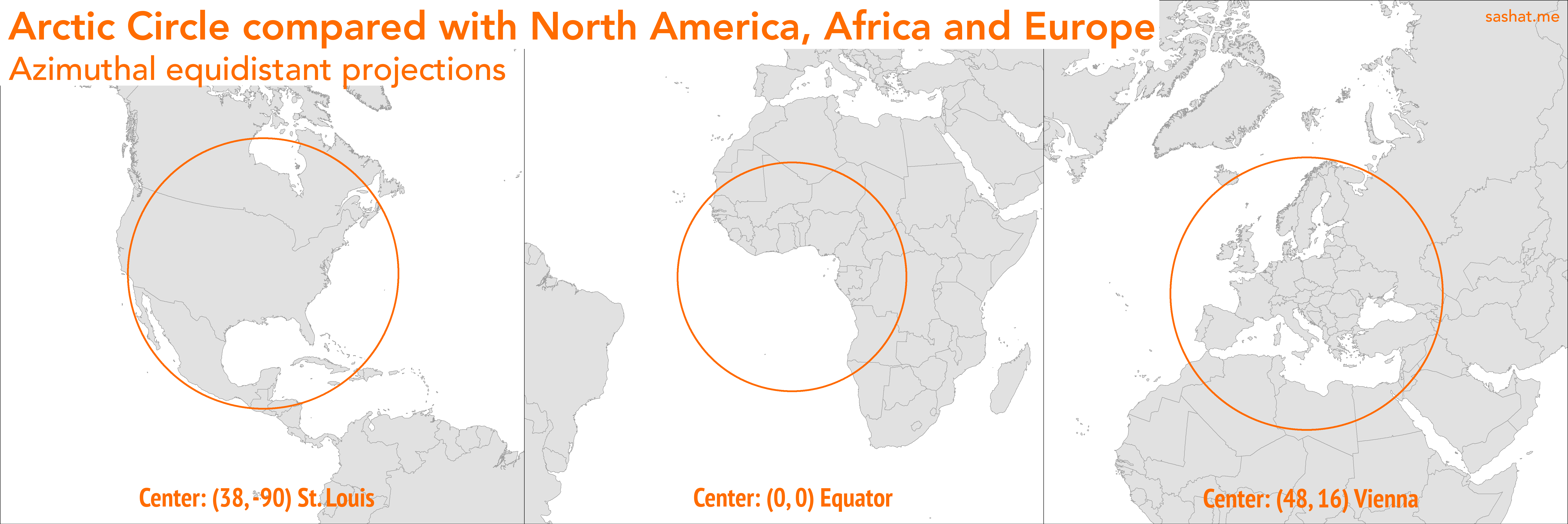
The Map Porn subreddit has a requests page now, which is pretty awesome. User Mjager asked what the Arctic Circle would look like projected near the equator, to get a sense of scale. I decided to just go ahead and do it.
The radius of the Arctic Circle varies minutely with each year. Also, “projecting” is onto the Equator is tricky because the Earth isn’t a perfect sphere, yet the Circle is defined in terms of latitude. I decided to settle for a nice, round 2,620 kilometers, which works just fine at our small (1:50,000,000) scale.
I centered one map roughly on the city of St. Louis, to compare the Circle with the US and North America. The second one is centered right at the intersection of the equator and prime meridian. The third map is centered near the city of Vienna, Austria, which I just arbitrarily chose as a decent center-point for Europe.
Personally, I wasn’t really shocked or dismayed at the size of the Circle, it was basically what I had expected. It’s a pretty big area, bigger than the US or Europe, but not that massive on a global scale. It seems even more unassuming when you consider that Sweden and Alaska are on opposite sides of this circle. In other words, Egypt and Iceland are farther apart than Sweden and Alaska. That’s much closer than it would seem just by looking at a world map!
Just a side note, the maps are 1:50,000,000 scale except for the Africa one. It’s slightly zoomed out but I’m too lazy to redo it.