Roman Roads of Italy
27 May 2018


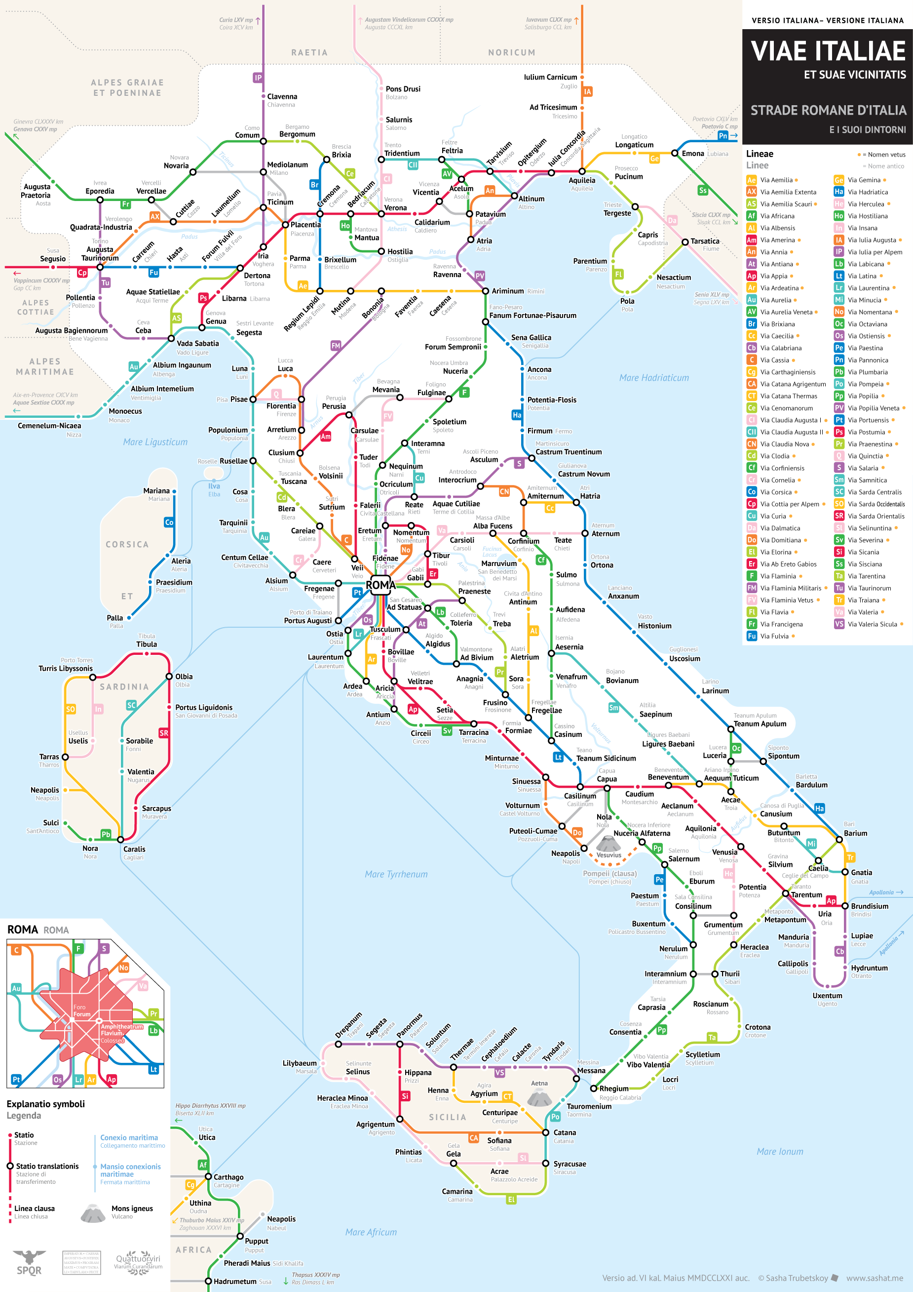
Versione italiana — Italian version
Notes:
It’s taken me almost a year to get around to doing this, but as promised, here is the transit-style map of the ancient Roman roads of Italy!
The same caveats apply to this map as the previous ones. It was fortunate enough that Italy’s Roman roads are quite well-studied and documented, especially when it comes to their actual ancient names. This meant that I had to do less artistic interpretation in order to make this look like a sensible, modern chart. That said, there are still some cases where I had to creatively reconstruct certain roads, and I make it clear in the legend which roads those were.
Some people might be confused about why Sicily and Sardinia are beiged out. This is a map of Italia (Italy) as the Romans saw it, which did not include those islands. On the other hand, it did include parts of what are today Slovenia and Croatia.
Not sure what else to write about this right now, but I will update this description as time goes on.
Grateful to @cheremone for checking my Italian translation and offering many helpful changes!
Fixes made as of 28 May 2018:
- Thermae is now Termini Imerese, not Sciacca.
- Nuceria is now Nocera Umbra, not Nocera Inferiore.
- Libarna still called Libarna, not Liguria.
- The road from Florentia to Bononia was called the Via Flaminia Militaris and started at Arretium. There was also the Via Flaminia Minor which ran parallel but through a different mountain pass, but it does not appear in all sources and may have been disused by the time of the Empire, so I am not including it.